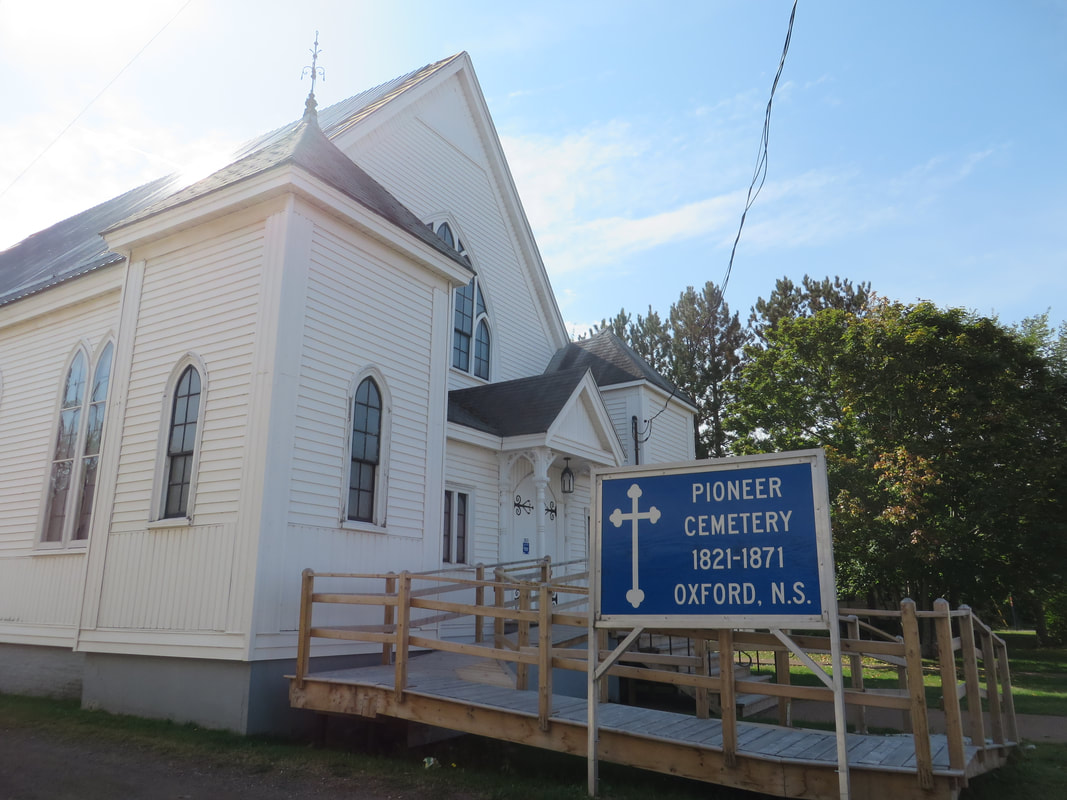
 The Pioneer Cemetery is located behind Trinity United Church in Oxford. | 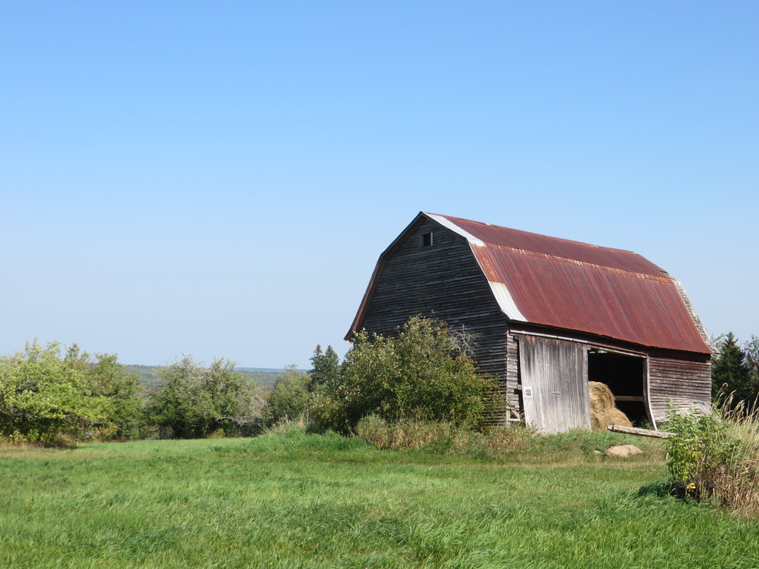 Probable location of homestead of Thomas and Joseph Ripley in West Hansford. |
I'm very happy with my decision not to waste any more time at the Archives as I had a very productive day enroute to Amherst. I stopped in the town of Oxford to look at a few cemeteries and try to locate the former homesteads of John Ripley and his sons Robert, Thomas, and Joseph.
The Pioneer Cemetery was easy to find. It's located behind the Trinity United church on Main Street right across from the Community Hall which also houses the tourist information centre. The cemetery was destroyed in order to create a parking lot years ago, but fortunately the Reverend Aubrey Tizzard later researched who had been buried there and printed the information in a 12-page booklet entitled "Where Pioneers Sleep in Oxford." The area is once again a cemetery and the Wells Foundation has created a monument listing the names of those who are buried there. These include John Ripley's son Robert (1800-1853) and his wife Elizabeth O'Brien (1800-1841).
Next I continued on Main Street toward Kolbec. I believe that the homestead of John Ripley (1770-1853) was located just north of this road between Oxford and the Mt. Pleasant Road. I took some photos which I will later post to the Homestead of John Ripley page on this website.
I turned left on the Mt. Pleasant Road and found the Mt. Pleasant Cemetery on the right hand side a short distance up the road. This is a very large cemetery and the only Ripley I found was Priscilla (Embree) Ripley (1809-1892) wife of John Ripley's son Thomas Ripley (1801-1871). I'll add the photo of her grave to the Grant of Joseph Black Ripley and Thomas Ripley page on this website.
Continuing up the Mt. Pleasant Road a few kilometres I found the Ripley Loop Number 15 Road. I believe the Ripley Loop Road ran through a corner of the homestead of Robert Ripley (1800-1853) and his wife Elizabeth O'Brien (1800-1841), the couple buried in the Oxford Pioneer Cemetery. I took a few photos in the general area and will post those to the Grant of Robert Ripley page on this website.
At this point, I backtracked to Oxford and turned left on Water Street and then left again on the Hansford road. I believe the Hansford Road is Gray's Road on earlier maps. I continued about 3 km to Joe Maine's Road, a well-traveled gravel road coming in from the right. There is no road sign, but my GPS identified the road. I believe this is called Mayne's Road on earlier maps. The homestead of Thomas Ripley (1801-1871) and Joseph Black Ripley (1803-1879) is located across from Joe Maine's Road. There's a very picturesque old barn in the field on this property. I'll post photos on the Grant of Joseph Black Ripley and Thomas Ripley page of this website. Joseph later sold his share of the homestead to brother-in-law Henry Mayne, husband of his sister Esther, and moved to River Philip.
I was reminded today of why I'm so fascinated with deeds and grants. When you understand where people settled, the family relationships become very clear. Given the location of these grants and homesteads and where family members are buried, it's obvious that the family of Joseph Ripley and Margaret Donkin settled in the Oxford area. It was only son Joseph who later moved down into what we call River Philip today, near Collingwood Corner. Ripleys found in that area are his descendants.
 RSS Feed
