Land Grant 2937
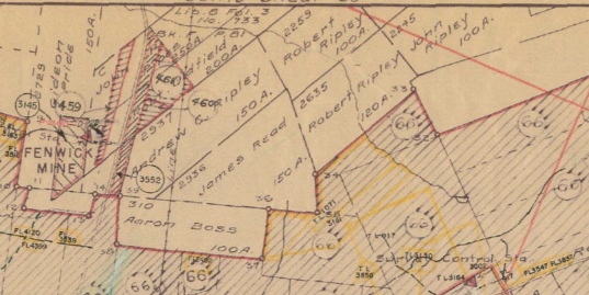
On February 15, 1854, Andrew C. Ripley (abt 1812-abt 1891), then 42 years of age, applied for a grant of 150 acres of Crown Land in the district of Maccan in the County of Cumberland at the price of 1/9 sterling per acre. A report on the land by Thomas Login, Deputy Surveyor, confirmed that it was "in a wilderness state and unplanted. Some portions of it is of excellent quality and some part of it ...with spruce timber trees. The lot is well worth the ...price of 1/9 sterling per acre. I believe the land is free to be granted to the applicant." (RG 20, Series E, F-2937; Mfm 15814). The grant was approved on January 15, 1855. Crown Land Index maps of Nova Scotia, which show the original land grants, are available for online viewing, download, and purchase at the Nova Scotia Department of Natural Resources website. Andrew's grant is visible near the top middle of map 60 directly east of the old Fenwick Mine. Andrew's grant adjoins the property of Robert Oldfield, the southernmost portion of the large Samuel McCully Grant.
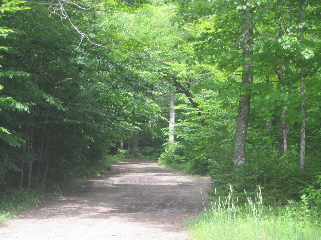
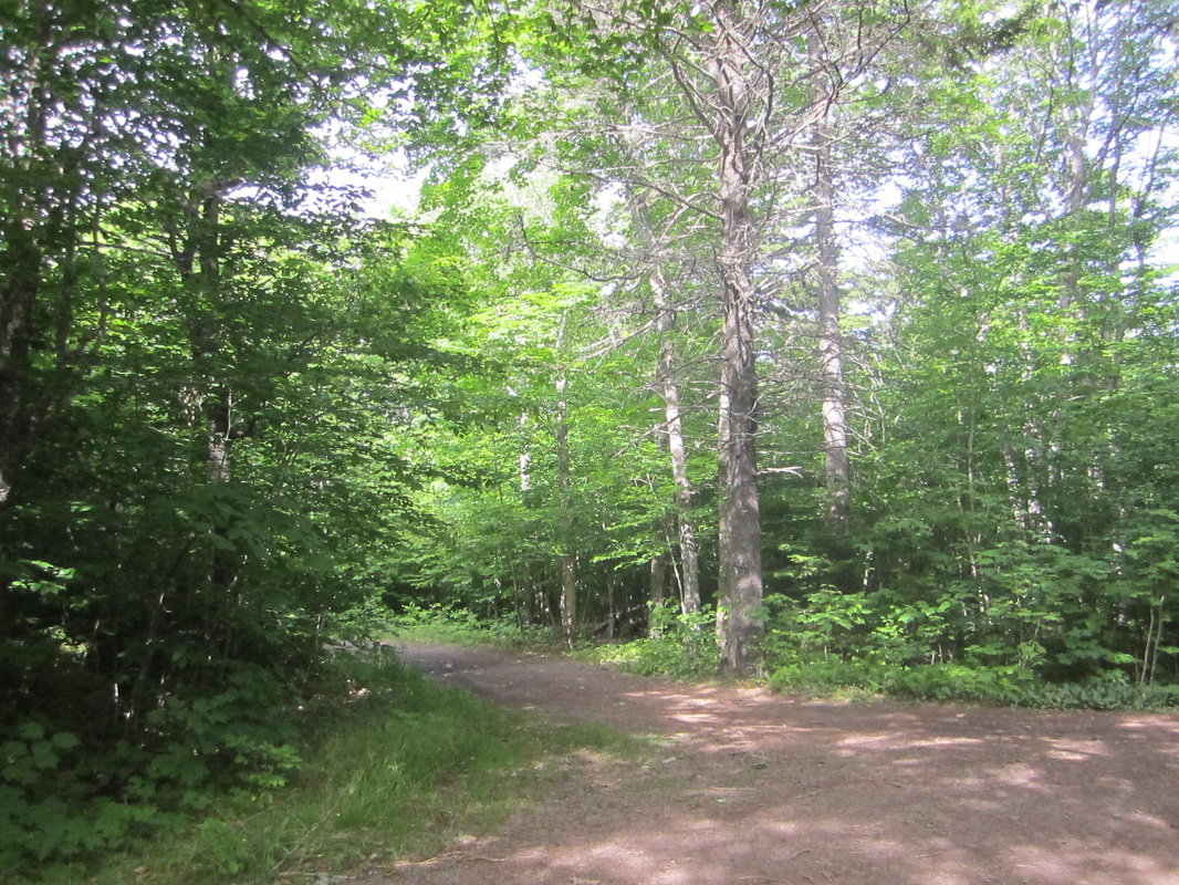
When I visited in July 2014, Neil R. Ripley who runs a sugar camp nearby was able to tell me exactly where the old mine was located, just up the very next hill towards Springhill from the turn-off to his sugar camp on the same side of the highway. Apparently there was once a Provincial Park at the top of the hill and the generous pullouts and back roads are still visible. The mine was located on the west side of the highway and the majority of Andrew's grant on the east side although the highway might run right through the corner of Andrew's original grant.
When I visited in July 2014, Neil R. Ripley who runs a sugar camp nearby was able to tell me exactly where the old mine was located, just up the very next hill towards Springhill from the turn-off to his sugar camp on the same side of the highway. Apparently there was once a Provincial Park at the top of the hill and the generous pullouts and back roads are still visible. The mine was located on the west side of the highway and the majority of Andrew's grant on the east side although the highway might run right through the corner of Andrew's original grant.
|
|
I have not yet been able to determine for certain which Robert and John Ripley received the adjacent grants. There are a John Ripley and a Robert Bean Ripley living near Andrew C. Ripley on the 1871 census and on the 1873 A. F. Church map. This John and Robert B. Ripley are the sons of Henry Ripley (1762-1835). John Ripley of Nappan applied for 114 acres in the District of Maccan adjoining land of Thomas Bacon on December 17, 1852. (RG20, Series E, F-2245) Robert Ripley applied for a hundred acres of crown land adjoining the land of Thomas Bacon on March 11, 1853. (RG20, Series, E, F-2259) On February 27, 1857, Robert Ripley of Nappan applied for 120 acres in the District of Maccan adjoining land previously granted to the Petitioner. (RG20, Series E, F-3635) This would indicate the two grants to Robert Ripley were made to the same person. The land for both of Robert's lots was reported inferior for cultivation but covered with valuable spruce timber.
It doesn't appear that the petitioners actually lived on their grants after they were acquired. Since Andrew C. Ripley was living near the crossroads of Hwy 2 and Fenwick Road at the "home place" in 1873 he may never have lived on the land grant. We know from Login's description that the grant property contained valuable spruce timber so perhaps Andrew used it mainly as a woodlot and sugar bush. According to Myrtle Chappell's Fenwick 1778-1978, p. 84, the logs used to build the first church in Fenwick in 1886 were sawn at Andrew's mill at the Mill Brook. Mill Brook is shown in a map of the 1815 land grants on page 47 of Myrtle's book. Myrtle was probably referring to the 1816 McCully Grant made to Samuel McCully, John Parkinson Pipes, Thomas Forrest, and Robert Oldfield. The grants of Andrew, John and Robert Ripley were made in the 1850's. Mill Brook was well northwest of Andrew's grant on this map and may be today's Baird Brook in the vicinity of Ripley Branch Road.
It doesn't appear that the petitioners actually lived on their grants after they were acquired. Since Andrew C. Ripley was living near the crossroads of Hwy 2 and Fenwick Road at the "home place" in 1873 he may never have lived on the land grant. We know from Login's description that the grant property contained valuable spruce timber so perhaps Andrew used it mainly as a woodlot and sugar bush. According to Myrtle Chappell's Fenwick 1778-1978, p. 84, the logs used to build the first church in Fenwick in 1886 were sawn at Andrew's mill at the Mill Brook. Mill Brook is shown in a map of the 1815 land grants on page 47 of Myrtle's book. Myrtle was probably referring to the 1816 McCully Grant made to Samuel McCully, John Parkinson Pipes, Thomas Forrest, and Robert Oldfield. The grants of Andrew, John and Robert Ripley were made in the 1850's. Mill Brook was well northwest of Andrew's grant on this map and may be today's Baird Brook in the vicinity of Ripley Branch Road.
Location of Andrew's Grant
Starting from the intersection of Hwy 2 and Fenwick Road, head south on the road to Springhill. A little less than three km at the bottom of the hill, the road curves to the right. You will see a guard rail and then three No Parking signs in a row. Maple Lane, the turn-off to Neil R. Ripley's sugar camp is on the right. Continue to the top of the hill and you will see the pullouts from the previous Provincial Park. The Old Fenwick Mine was located in the woods to the right (west) and the majority of Andrew's grant was located in the woods to the left (east). However, the road likely runs right through the corner of his former grant.
Starting from the intersection of Hwy 2 and Fenwick Road, head south on the road to Springhill. A little less than three km at the bottom of the hill, the road curves to the right. You will see a guard rail and then three No Parking signs in a row. Maple Lane, the turn-off to Neil R. Ripley's sugar camp is on the right. Continue to the top of the hill and you will see the pullouts from the previous Provincial Park. The Old Fenwick Mine was located in the woods to the right (west) and the majority of Andrew's grant was located in the woods to the left (east). However, the road likely runs right through the corner of his former grant.
