To Build a Methodist "Chapple"
(Nappan Methodist Cemetery)
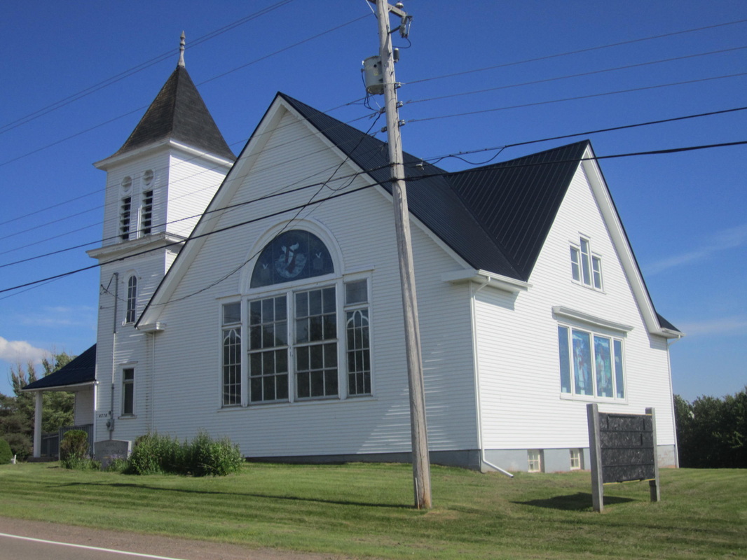
United Church built in 1919 just around corner from cemetery and war memorial.
On 20 Jul 1825, the numerous heirs of the late J. F. W. DesBarres granted a parcel of land to Henry Ripley, William Ripley, and James Shipley at the price of 5 shillings for "the purpose of building a Methodist Chapple". (Deed Book I, p. 427, Document #503710984, Registered 1826.) Henry and William Ripley were both sons of Robert Ripley and Isabella Beane and James Shipley was married to Henry's daughter Isabella. The deed indicates that DesBarres heirs were carrying out the wishes of their honoured father and their own good wishes in establishing this church. As staunch Methodists, they also stipulated that only the doctrines based on "John Westley's (sic) notes" be preached in the chapel. The location of the parcel is described as follows: "being in Napan in the County of Cumberland abutted and bordered(?) as following Bounded by the road leading from Napan to Parrsboro beginning at a stake a Stake (sic) and running south forty degrees, West three chains and fifty links thence running north eight degrees degrees , two chains thirteen links thence West course(?) to the place of beginning, containing two Roads and one pole."
You have to wonder what happened the first time modern surveyors had to legally sort out "metes and bounds" descriptions like that. There is indeed a United Church at 4278 NS Hwy 302 near the intersection of the Nappan Road Hwy 302 and Southampton Road but that Church was built in 1919. There is also an old semi-circular shaped Nappan Methodist cemetery and war memorial on the same corner and south of the United Church facing the road to Maccan. In Susan Hill's book, Some Cumberland County Cemeteries Nova Scotia Cemeteries, it's called the Nappan Cemetery. Location #10 on the hand-drawn map given by Ernest Coates to Gordon Ripley is located at the intersection of those roads and reads "Old Church site, graveyard, Great War Monument, Graves of James Read, Mr. and Mrs. Francis Smith." It's highly likely that this was the location of the parcel of land mentioned in the deed. Location #11 on the Ernest Coates map reads: old school all gone today. Ephraim Smith born 1872 went to this school. Location #12 on the Ernest Coates map is the United Church built in 1919, pictured above. Strangely, none of the original grantees is buried in the Methodist Cemetery.
The 1873 A. F. Church map has an M.E.Ch. and S.H. at this location which could be abbreviations for Methodist Evangelical or Episcopal Church and School House. The following photos were taken in July 2013.
