Robert Salter Ripley and Hannah Elizabeth Ripley: The Blenkhorn Place
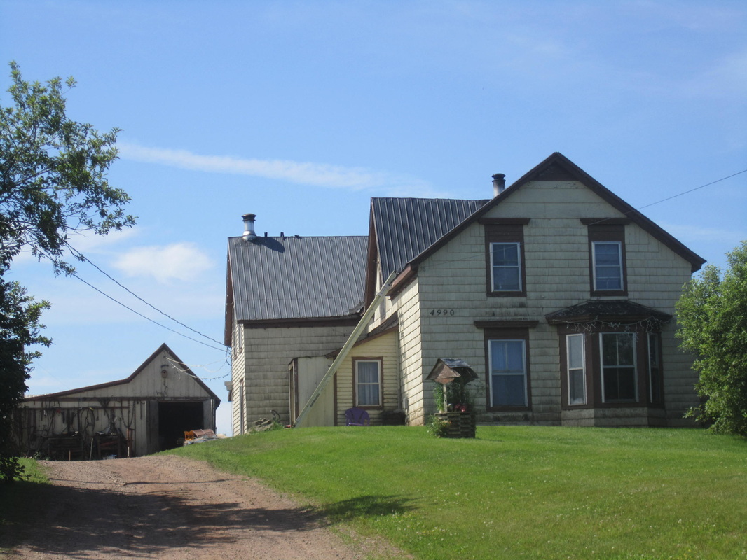
The Blenkhorn Place in 2013
|
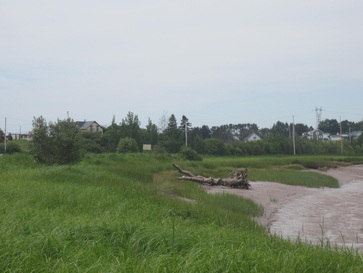
The Blenkhorn Place on the left viewed from Maccan Tidal Bore Park with zoom.
|
The Deeds
In 1893, my grandmother Alice Malinda Ripley was born in her family home, located near the bridge over the River Maccan. This property, known more recently as the Blenkhorn place, and a property sold by Jonathan Vickery Ripley to Jeptha Harrison were located at the southern end of the original homestead of William Ripley and Hannah Coates. In July 2014 a visit to the Deeds office in Amherst turned up two surprising transactions. On 5 August 1896, William Coates Ripley and his wife Cynthia Pipes Ripley sold a 45 acre property near the Maccan Bridge to my great grandparents, Robert Salter Ripley and his wife Hannah Elizabeth Ripley, for $1500. (Deed Book 45, p. 518, Document #502947811). William Coates Ripley was Hannah Elizabeth Ripley's brother. Two days later, on 7 August 1896, Robert Salter Ripley and his wife Hannah Elizabeth Ripley sold the property to Frank Blenkhorn for $2800. (Deed Book 45, p. 519, Document #502947812). Either Robert Salter Ripley was a first-class scoundrel or the property was transferred for the purpose of selling. William and Elizabeth's mother, the widowed Rebecca (Vickery) Ripley, was alive until 1903 so the property must have already been transferred to William sometime after the death of his father Robert Ripley in 1865.
Despite the quick sale, it appears that Robert and Hannah Ripley had lived on the property since at least 1881. On the 1881 Maccan census they were listed next to the families of Nather(?) Harrison, Alexander Harrison, and John W. Pugsley (1832-1882) whose family included John's wife Margaret, son David, and his unmarried sisters Elizabeth, Phoebe, and Augusta. John Pugsley died in 1882 and is referred to in the above deeds as the late John Pugsley. John was the son of David Pugsley (1800-1875) and grandson of David Pugsley UEL (1759-1841) who originally purchased the Pugsley property.
Further confirmation that the Robert Salter Ripley family lived in this home is provided by a photo labelled "The family homestead Macan" which appeared in a Ripley family history written by Edith Seaman Ripley. Edith married Robert Douglas Ripley, son of Robert Salter Ripley's son James Trueman Ripley. James Trueman Ripley lived until 1974 and would have provided the information about the family home to his daughter-in-law. Edith's photo was taken from the bridge side (west) while my photo was taken standing directly below the house and looking at it from the north.
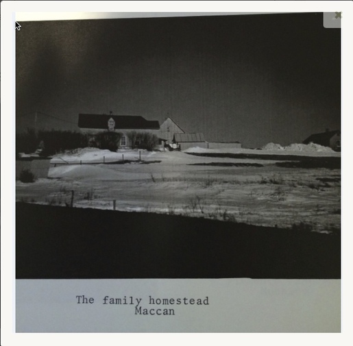
This photo appeared in the Ripley Family History by Edith Seaman Ripley who retains the copyright.
The Robert Salter Ripley to Frank Blenkhorn deed describes the property as follows (Deed Book 45, p. 519, Document #502947812):
"Beginning at South side of Main Road leading from River Hebert on the bank of the river Maccan at the south east corner of the bridge & following the southern bounds of said road until it reaches the South Western bounds of lands formerly owned by Jonathan Ripley thence following said bounds until it reaches lands owned by heirs of the late John Pugsley thence Westerly along the northern bounds of said Pugsley's land until it reaches the Maccan River thence down the River its various courses to the place of beginning containing forty five acres more or less Excepting one fourth of an acre previously deeded by Robert S. Ripley to John Babineau. Also excepting the building used as a Blacksmith Shop situate on the east side of the road leading to Maccan Station."
The land "formerly owned by Jonathan Ripley" is likely the parcel which had been sold by Jonathan V. Ripley to Jeptha Harrison 9 August 1885. (Ernest Coates Paper 05-050-05 D01 aas #1; photocopy of the deed but no deed book reference given) The parcel is described as follows:
"Beginning on the east side of the Intercolonial Railway and at the south line of land owned by James Ripley, brother of the within named Jonathan V. Ripley thence running Easterly and along said line until it reaches the Western line of lands known as DesBarres lands southerly(?) along said line until it reaches the Northern bounds of the Puglsey lands thence along said Northern bounds Westerly until it Crosses the Road leading from Amherst to Parrsboro a few yards to the West of said Road thence(?) it reaches land occupied by Robert S. Ripley thence Westerly along the Northern bounds of said land until it reaches the Eastern bounds of said Rail Road thence Northerly along said Railway to place of Beginning excepting and reserving of the bounded land the road or Highways xxx xxx said land. Also the two lots formerly sold to James Gould and Stephen Gould said lots containing less than one Acre, containing by estimation between forty or fifty acres more or less."
When I visited the area in 2014, Art Ripley pointed out a straight line of trees near the house built by his father Harold Garfield Ripley, that was the boundary between the Ripley and Harrison lands. "Jep" Harrison sold to Irwin Boss. As mentioned above, the Robert Salter Ripley family is listed right next to the John Pugsley family on the Maccan 1881 census and John Pugsley died in 1882. Jonathan Ripley is a brother of Robert Salter's wife Hannah Elizabeth Ripley and also William Coates Ripley. All three were children of Robert Ripley and Rebecca Vickery who likely inherited the original homestead of William Ripley and Hannah Coates. I have recently obtained a deed from Robert S. Ripley to Elizabeth Babineau (Deed Book 13, p. 233) for a very small parcel of property. This deed was registered in 1885, providing more confirmation that the Robert S. Ripley family was living on the property prior to its sale to Frank Blenkhorn in 1896. It's interesting that Robert S. Ripley was able to sell a property he didn't officially own yet.
The DesBarres/Francklin Line
The original 420-acre homestead of William Ripley and Hannah Coates was originally part of a 20,000-acre grant to Adam Gmelin. The northernmost 8,000 acres of Gmelin's grant were later acquired by J. F. S. Desbarres, and the southernmost 12,000 acres went to the Hon. Michael Francklin. William Ripley acquired his homestead from DesBarres, and the Pugsleys, his neighbours to the south, acquired their homestead from Francklin. So the southern boundary of William's homestead was located on the dividing line between the DesBarres and Franklin properties.
According to Old Plan 520 dated 5 Sep 1786 (Ernest Coates Map File at the Cumberland County Genealogy Centre), the dividing line between the DesBarres/Francklin lands was located just south of the road to River Hebert and formed the southern boundary of that purchase. The DesBarres/Francklin line was probably located about where the Cenotaph near Maccan Station is now located. As mentioned in the deed of sale, a Blacksmith Shop was excluded from Robert Salter Ripley's sale to Frank Blenkhorn. A Maccan resident confirmed that there was indeed a Blacksmith Shop on Hwy 302, south of the turnoff to River Hebert (Hwy 242) and just north of the cenotaph, about halfway to Maccan station on the west side of the road. In fact, his family home was located across the street from the shop and he worked there as a young man turning the forge for owner Judson Trenholm. The location of the Blacksmith Shop is significant because it is likely on or near the southernmost border of William's original homestead.
The deed mentions that the property of Robert Salter Ripley was bordered on the south by the lands of the late John Pugsley. In 1794, John's grandfather David Pugsley UEL and Nathaniel Hoeg purchased 10,000 acres from James B. Francklin. Francklin had purchased the property from Michael Bennett, the property having been owned formerly by his father Michael Francklin Esquire. The northern boundary of this property was the land in possession of Joseph Frederick Wallet DesBarres. The southern boundary of William Ripley's original homestead were the Francklin lands. (Deed Book D, p. 230, Registered 1794 Cumberland County, Document #503706961).
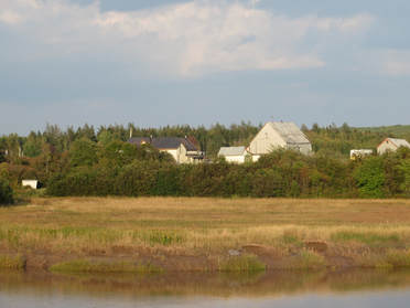
View of the property from the Maccan River Bridge.
|
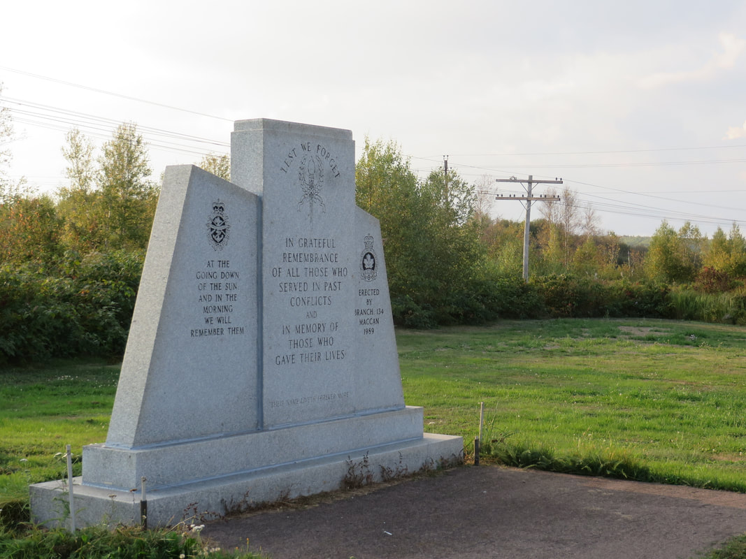
The blacksmith shop mentioned in the deed was located just north of where the cenotaph stands today.
|
