Andrew C. Ripley and Elizabeth Pipes: The Home Place
|
|
Myrtle Chappell describes the location of Andrew Ripley's "home place" in Fenwick 1778-1978 on pages 67 and 68. "Again we start at the church in the centre of Fenwick and journey up the road to the south, the road that leads to Springhill." Myrtle first describes several houses on the right hand side of the road traveling south. Then she crosses briefly to the left side of the road before returning to the right side. "There are only 5 old homesteads on this road, and the next house on the west side is one of the oldest places. It was the homestead of Andrew Ripley and his wife, Elizabeth Pipes." Myrtle points out that we are not sure whether Henry was Andrew's father but she does list most of Andrew's children and their spouses including "Ann Jane, William Henry and Amos who never married, all remaining on the home place."
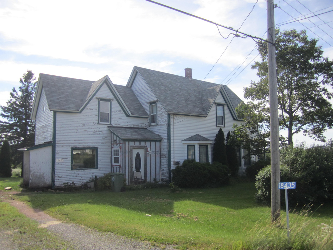
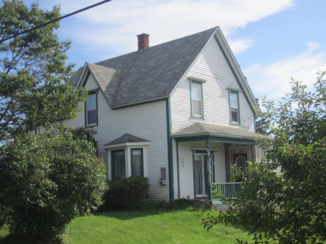
Apparently the original house burned and the three siblings constructed a large house that was never completely finished. The house was next owned by Fred Shipley and his wife Hilda Trueman, then by Hilton Nelson and Moira Chadwick. According to Myrtle, the house now has two apartments. She provides a photo of the house on page 67. Myrtle's account coincides with the location of Andrew's residence on the A. F. Church map. Using Myrtle's photo, I was able to locate the house on Hwy 2 in July 2014.
I was also able to locate the purchase deed. On 15 January 1834, Andrew C. Ripley purchased 100 acres known as Lot #5 in Nappan for 45 pounds from Augustus DesBarres (heir of J. F. W. DesBarres). The deed mentions that the land was formerly in the possession of John Higgs and borders the land of Henry Ripley. (Deed Book M, p. 253 Document #503713505, Registered 1834.) Andrew would have been about 22 years old and likely married Elizabeth B. Pipes about the same time as their first child was born in 1835. In 1834 Andrew had witnessed Henry Ripley's will which he could not have done as a beneficiary It would be interesting to know how Andrew acquired the money to purchase the parcel at such a young age and the nature of his obviously close connection to Henry. Henry died the next year, in 1835.
The location of Andrew's property is further confirmed by a facsimile of the "Plan by William Baker of DesBarres estate at Nappan, Cumberland Co., N.S." which I found in Ernest Coates's map file at the Cumberland County Genealogical Society. The following notation appears on Lot 5: "Book M, page 252 Deed 1834 to Andrew Ripley from A.W. DesBarres". Henry's land is shown to the north. A smaller version of the map includes the additional information "100 acres" and "lately in possession of John Higgs". The second map clearly shows that Andrew's property is bounded on the east side by highway 2 from Amherst to Springhill.
The intersection of Hwy 2 and Fenwick Road is also clearly indicated on the Crown Land Index Map 59 which shows the grants of Robert Oldfield, Thomas Bacon, and John Ripley which are just north of Andrew's Land Grant 2937. It appears the location of Andrew's Land Grant is much further southeast than his residence and this was confirmed during my July 2014 trip.
Other Mortgages and Sales
On 30 Aug 1845, Andrew mortgaged the 100 acre property known as Lot 5 to James Fullerton for 41 pounds plus interest for an unspecified number of years. (Deed Book S, p. 629, Doc #503719661) On 9 August 1863 he mortgaged the same property to brother-in-law Jonathan R. Pipes for the term of one year for $555 plus 6% interest. (Deed Book HH, p. 408, Doc # 503710421). Andrew must have paid back both mortgages because his children did inherit the home place.
Andrew also sold two pieces of property to his son Joseph E. Ripley in 1880 (sic) for $500. (Deed Book 16, p. 80, Doc #503694905, Reg. 1887)
The first property is described as follows: "Beginning at the North East angle of lands owned by Francis Smith running with William Ripley's line south Eight Eight degrees East seventeen chains to Main Road thence with road south six degrees West seven chains and seven links then North Eighty six and a half degrees West sixteen chains and eighty nine links to East of line of Frances Smith's land thence seven chains North from line to place of Beginning." According to notes made by Ernest Coates on a page in his Maps File, Lot 6, adjacent to Andrew's Lot 5, was originally purchased from DesBarres by Thomas Lowther (Deed Book M., p. 326, Reg. 1834) and then passed to John Wesley Lowther (Deed Book AA, p. 124, Reg. 1856) and to Francis Caleb Smith (Deed Book NN, p. 555, Reg 1869). Henry Ripley's land just north of Andrew likely passed to son William Ripley, and Andrew's property borders the main road. So this property appears to be a northern portion of Andrew's original hundred acres between Lot 6 and the main road or an additional piece of property he acquired just north of his original hundred acres.
The second property is described as follows: "Beginning at the NorthWest angle of land lot Number One Running with lot Number One south forty-nine degrees west to a Maple Tree thence North eighty four degrees West to a Maple Tree thence Fifty One degrees East to ___ ___ on West side of Noil(?) Road then with Noil(?) Road south __ ___ degrees East seven chains and seventy eight links to place of Beginning." Lot Number 1 belonged to George Noiles and was west of property owned by Henry Ripley whose property formed the northern border of Andrew's Lot 5, Frances Smith's Lot 6, and most of Lot 7, so this property is well to the northwest of Andrew's original 100 acres.
