Homestead of Henry Ripley and Mary Fawcett
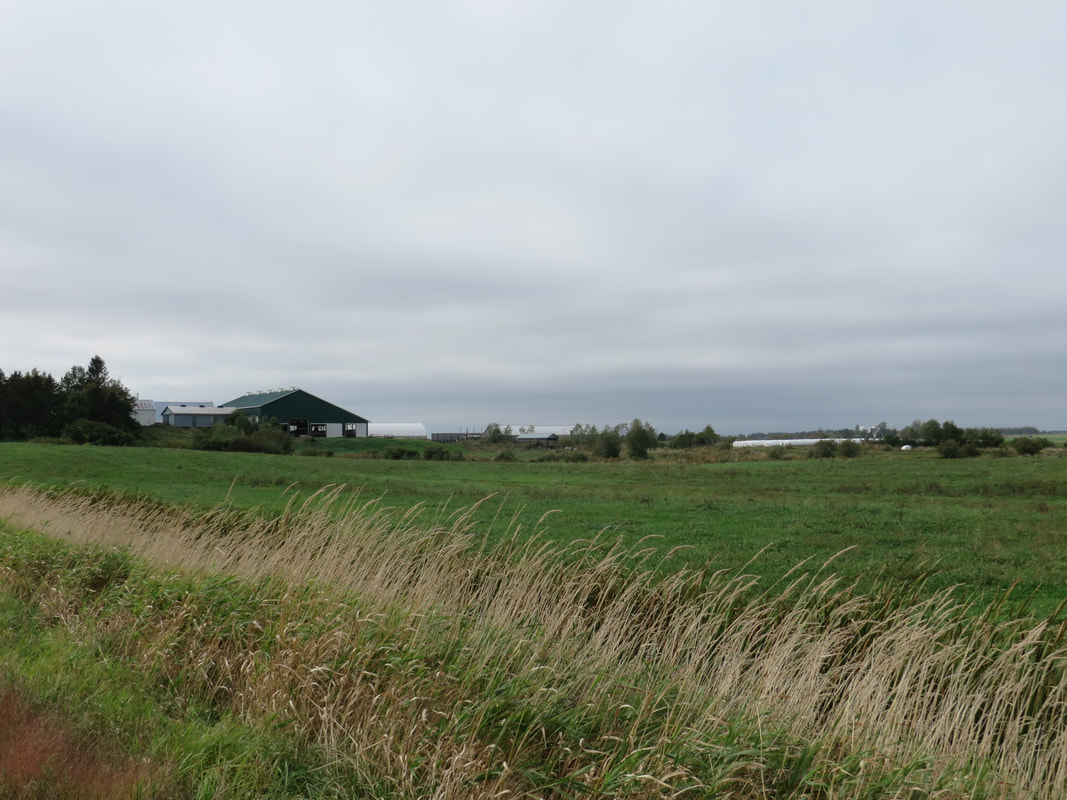
Looking north from the corner of Higgs and Nappan Roads (Hwy 302).
Henry Ripley, the Gould Family, and Landlord DesBarres
In 1795, Captain John MacDonald visited the DesBarres properties at Maccan, Nappan, Minudie and Tatamagouche and filed a detailed report. According to MacDonald's report, Tenant 11 was
“_____ Ripley
a very industrious thriving young man of excellent character—has built a bolding mill—his place is on the upper part of Napan, having bought out one Gallong an Acadian now at Malpec in this Island.”
On October 10, 1780, John Galong [sic] and Lewis Gould had leased 152 acres from J. F. W. DesBarres for a term of 990 years at a yearly rate of 3 pounds, 6 shillings, and 6 pence. The boundaries of the property were not described in the lease agreement. DesBarres’s mistress, Mary Cannon, who had been given Power of Attorney during his long absence from Nova Scotia, signed the transaction. Thomas Coates and William Pipes signed as witnesses. (Deed Book D, p. 259, Document #503706983, registered 1795, Cumberland County.)
On May 3, 1788, John Gallong gave up his interest in the property, house, barn and grist mill to Henry Ripley for the sum of 15 pounds. (Deed Book D, p. 259-260, #503706983, registered 1795, Cumberland County.) This transaction was signed by John Gallong and witnessed by John Walters and Robert Ripley. In 1799, Henry and Mary Ripley made a further agreement with Lewis and Mary Gould to formalize the boundaries between their respective properties. While Henry Ripley relinquished a small piece of marsh to Lewis Gould, he retained access to "the Mill Creek and the Mill Race as it now runs." (Deed Book E, p. 57, registered 1799, Cumberland County Document #503707631). John Gallong mentioned in the deed is actually Jean Gallant, Louis Gould's brother-in-law as confirmed in this paper from the DesBarres estate. (DesBarres Papers, Series 5 M.G. 23, F1-5, Vols. 19-20 Lands-Correspondence 1795-1812).
The 8,000 acres that DesBarres owned in Maccan and Nappan had previously been part of a 20,000-acre grant to Captain George Adam Gmelin. After DesBarres acquired the property, the Township of Amherst disputed the boundary between the Amherst Grant and Gmelin's original grant. At the time of MacDonald's visit in 1795, Henry's property was in dispute, along with a property occupied by tenants 12 Teodore [sic] Gould and 13 Francis Gould. (See Landlord DesBarres and Captain Gmelin for details on how DesBarres acquired the property and The Gmelin Line on this website for a thorough examination of the boundary dispute between DesBarres and the Township of Amherst.)
From about 1776, DesBarres had left the management of his properties to his abandoned mistress Mary Cannon. For several decades, he ignored Mary's requests for help in managing the properties. In order to attract tenants to the properties in Maccan and Nappan, Mary had offered leases of 990 years with very favourable terms. However, when DesBarres moved to Amherst in 1812, he sued Mary for mismanagement and tried to invalidate the leases she had made with his tenants. DesBarres denounced the subleases such as that from John Gallong to Henry Ripley as illegal forgeries. In 1815, DesBarres sued Henry Ripley to dissolve his lease, but Henry prevailed in court. DesBarres and Henry then came to an agreement regarding the purchase of the property. (DesBarres Series 5 (MG 23 F1-5, Volume 25, pp. 6606-6607. On Reel C-1461, Image 427). For a very amusing account of the settling of the DesBarres leases and the "treachery" of his abandoned mistress Mary Cannon and the Yorshire tenants, see DesBarres papers, Series 5 (M.G. 23, F1-5, Vols 22-23, pp. 5245-5259 on images 294-307.
Location of Henry's Homestead
On July 9, 1816, Henry purchased 600 acres of marshland and upland from J. F. W. DesBarres for 775 pounds. (Deed Book G, p. 108, Document #503708995, registered 1816.) It is likely that the land Henry took over from Gallong was part of this purchase as the property adjoined land occupied by Frances Gould on the east. The boundaries of the property were described as follows:
“on a Stake on the Marsh next, the upland near the road adjoining lands occupied by George Niles thence several courses of the fence on the marsh adjoining said George Niles and Peter Niles to the River Napan thence along the several courses of the river to the said land occupied by Frances Gould thence across and [sic] Island and Marsh to a certain wild Cherry Tree on the edge of the upland adjoining said Gould and from the Cherry Tree forty five degrees east fifty five chains to a Spruce Tree, blazed, thence south sixty chains to a Yellow Birch Tree blazed, thence west forty chains to a Beech Tree, thence north til it meet the upper boundary of the lands occupied by the before-named George Niles thence down the said line to the place of beginning…”
Imagine my surprise when I stumbled on Thomas Roach's survey for Henry's property that includes all of these trees as landmarks. (DesBarres Papers, Series 5 M.G. 25, F1-5 Vol. 15 Reel C-1458 image 434).
According to Myrtle Chappell Fenwick 1778-1978, p. 17, “The Henry Ripley block was bought from Col. DesBarres around 1800, and contained 600 acres. It started at the Nappan River and came south to the top of the Fenwick hill, to the first base line. It was bounded on the west by the Noiles block, and on the east by the road leading in to Fenwick from Amherst.” Given the zig-zags of the boundary in the Roach plan, this is an obvious oversimplification. And, according to the boundary description in the deed, we also know that Frances Gould occupied the property to the east. The church at the corner of Fenwick Road and Hwy 2 is likely at the southeast corner of Henry's original homestead.
It's reasonable to assume that Henry's actual dwelling was located in the section near the Nappan River which he first sublet from John Gallong and was later inherited by son Joseph. According to Myrtle Chappell, Fenwick 1778-1978, p. 17, Henry's house was "back towards the brook on what we knew as the Higgs' place, and Howard Higgs says that when their home was built, part of the old house was moved over and attached for the woodshed. The lovely Higgs home is now part of the VanVulpin Estate and is occupied by Mr. and Mrs. Joe VanVulpin." Today there is a Higgs Road west of Hwy 2 that run roughly north/south between Nappan Road and Fenwick Road and VanVulpen Farms is located in this general area.
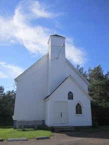
Church at corner of Hwy2 and Fenwick Road was near southeast corner of Henry's original purchase.
|
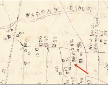
Henry's original home #50 was near corner of Higgs Road and Nappan Road.
(Ernest Coates hand-drawn map provided courtesy Gordon Ripley)
|
1835 Henry's Will
In Henry's will, proved 25th November 1835, Henry left all of his real estate to be divided equally among his four sons, John, Robert, Henry, and Joseph. Henry specified that each should receive the section which he currently occupied. In particular, he left John the section "bounded by the French to the Eastward" and Henry adjoining on the western side. Joseph was given a section "adjoining George Noile's land on which my house and other buildings are." Robert received the part lying between Henry and Joseph. Henry also received the use of the mill and all three brothers were allowed to take as much lime rock from Robert's property as they needed. As indicated on the 1873 A. F. Church map and on the 1871 Census, many of Henry's descendants were still living on the original homestead in 1873. It will take a closer look to determine which descendants lived where. Each son was given a long narrow section of land stretching from the Nappan River down to Fenwick Road--Joseph, Robert Bean, Henry and then John from west to east.
A hand-drawn map by Ernest Coates, given to me by Gord Ripley, identifies Henry's original location as #50 and the legend says "Henry Ripley's Grant, Henry, Joseph, Joseph sold to Albert Higgs, sold out now." Location #50 is near the intersection of Higgs Road and Hwy 302 on the south side of the road. Henry's son Joseph died in 1856. On July 1, 1870, Thomas Read Ripley (1835-1898), his second wife Matilda Esther Frazer (1849-1928) and his brother Stephen Brown Ripley (1848-1937) of Chatham Ontario sold 150 acres of upland and 25 acres of marsh to Abijah Higgs for $4600. (Deed Book OO, p. 330, registered 1870, Cumberland County, Doc. # 503715955). The boundaries are described as follows:
"Bounded on the north by the Nappan River, on the West by George and Peterman Noiles land, on the south by the lands of John Smith and Frances Smith, on the East by Robert B. Ripley, Henry Ripley, and Joseph Ripley's land...being the farm lately owned and occupied Joseph Ripley."
Robert Bean Ripley (1806-1873 originally inherited the section to the east of Joseph's. John and Francis Smith owned lots 6 and 7 south of the Fenwick Road. The description also lists some smaller parcels excepted from the transaction. By 1870 Joseph's son Joseph was the only one of his sons still living in the Nappan area, the others having moved to Ontario. On the 1873 A. F. Church map, there is a J. Ripley living very near an H. Ripley close to the Nappan River in the approximate location. On the 1871 census, there is a Joseph Ripley with wife Sara, who would have been Henry Ripley's grandson, living near an Abijah Higgs and his son Albert C. Higgs. By 1881, Joseph had also moved to Ontario, so there may have been another sale to the Higgs family.
Sources:
Acadian Genealogy Records is an excellent online list of resources. I particularly recommend Stephen White's genealogy of Acadian families and the list of Acadian prisoners at Fort Cumberland.
Gould is the anglicized name of the Acadian Doiron family. The father of this family was Pierre Doiron and his wife was Anne Forest. Pierre’s daughter Madeline Doiron was married to George Noils, Henry’s neighbour to the west. Pierre had a son named Louis Doiron whose wife was Marie Bonnevie, presumably the Lewis and Mary Gould mentioned in the Nappan deeds. Pierre’s daughter Anne married Jean-Baptiste Gallant, the John Gallong in the deeds. Pierre also had sons Francois and Isadore or Jadore. Some Acadians escaped deportation and others were imprisoned at Fort Beausejour and released in 1763 following the signing of the Treaty of Paris. A few Acadians were deported and returned. Several became tenants of DesBarres.
Chappell, Myrtle. Fenwick 1778-1978. There is no publisher or publication date listed and this book appears to have been self-published with proceeds donated to the Fenwick United Church. I purchased my copy online through a used book dealer. I highly recommend it to anyone with relatives from the Fenwick area.
Census, Assessment and Poll Tax Records 1767-1827 at Nova Scotia Archives online. Reference Number RG 1 Vol. 444 Poll Tax 1791-1794 Sheet 009 and 010.
Captain John MacDonald's 1795 report to DesBarres can be found online at Heritage Canada in Series 2 of the DesBarres Fonds. Series 2 begins at image 679 of reel C-1455.
The Gilbert Seaman Diary 1875-1885 transcribed by Susan Hill also includes a copy of the 1795 MacDonald Report to DesBarres on pages 93-108.
