Homestead of William Pipes Jr. and Elizabeth Oldfield
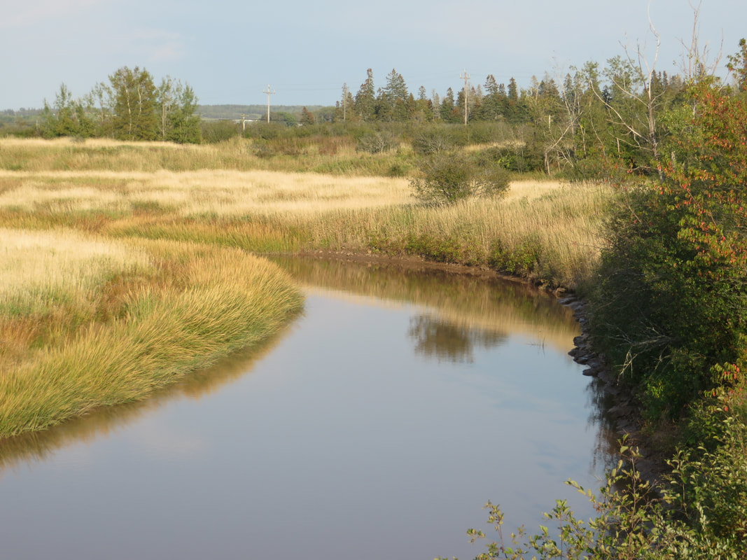
Nappan River north of the homestead
|
Lands once part of the homestead
|
1780 Original Lease
On 20 October 1780, William Pipes Jr. leased 324 acres of DesBarres land already in his possession and located on the River Nappan. The term of the lease was 990 years at a yearly rate of 8 pounds one shilling. (See DesBarres Fonds, Reel C-1458, Img 969). When Capt. John MacDonald visited DesBarres's leased properties in Nappan and Maccan in 1795, he provided a detailed account of William's farm. William had barely survived 3 very difficult years at the beginning, but he had prospered as a farmer. He had built an especially large and fine barn and was expanding his house and orchard (See DesBarres Fonds, Reel C-1455, starting on image 739). William Pipes and Thomas Coates, another 4th great grandfather, had also collaborated to build a bridge across the Nappan River. Thomas Coates occupied the lease to the west and south of William Pipes and Peter Noiles was his neighbour to the east. The Thomas Coates property, later sold to Samuel McCulley, became part of the Experimental Farm.
On 20 October 1780, William Pipes Jr. leased 324 acres of DesBarres land already in his possession and located on the River Nappan. The term of the lease was 990 years at a yearly rate of 8 pounds one shilling. (See DesBarres Fonds, Reel C-1458, Img 969). When Capt. John MacDonald visited DesBarres's leased properties in Nappan and Maccan in 1795, he provided a detailed account of William's farm. William had barely survived 3 very difficult years at the beginning, but he had prospered as a farmer. He had built an especially large and fine barn and was expanding his house and orchard (See DesBarres Fonds, Reel C-1455, starting on image 739). William Pipes and Thomas Coates, another 4th great grandfather, had also collaborated to build a bridge across the Nappan River. Thomas Coates occupied the lease to the west and south of William Pipes and Peter Noiles was his neighbour to the east. The Thomas Coates property, later sold to Samuel McCulley, became part of the Experimental Farm.
1804 Death of William Pipes Jr.
William Pipes Jr. left a will dated 18 Aug 1801 and died 31 Dec 1804. (See The Will of William Pipes Jr. on this website). His will stipulated that his property be divided among his four sons after the death of his widow Elizabeth. The appraisal of William's property included the "lease of lands on which the deceased lived at the time of his death from J. F. W. DesBarres worth 800 pounds". (Family Search Nova Scotia Probate Records 1760-1993, Estate File No. 1658-1627 O-P, Image 949.)
In 1813, following the death of William Pipes Jr.'s widow, Elizabeth, William Pipes (the 3rd 1777-1830) relinquished his interest in the property leased from J. F. W. DesBarres to his 3 brothers Jonathan, John Parkinson, and Amos Brown Pipes for 300 pounds. (Deed Book F, p. 302). He then moved to the Kolbec area.
1816 Purchase of the Homestead
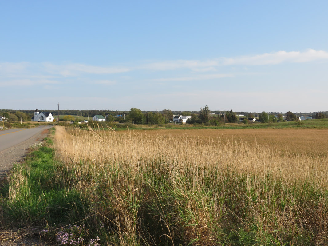
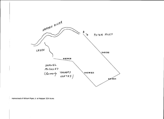
On 3 April 1816, William Pipes Jr.'s sons Jonathan Pipes, Parkinson Pipes and his wife Hannah, and Brown Pipes and his wife Isabella paid DesBarres 900 pounds for 324 acres of marsh and upland on the Nappan River, presumably the same 324 previously leased by their father. (Deed Book G, p. 258) The property began "at the line or boundary of Peter Niles and Running South forty three degrees east eighty two chains thence running south sixty one degrees west forty one chains thence running north forty three degrees west fifty two chains and fifty links thence running north eighty two degrees west twenty nine chains until it meets a small creek which empties into Nappan River and bounded on Samuel McCulley's land thence running the several courses of the River Nappan until it meets the first mentioned boundary containing three hundred and twenty four acres more or less." This property borders on the Nappan River and is north of the Experimental Farm, which was first leased by Thomas Coates and then transferred to Samuel McCulley. The sale exempted a 1/2 acre lot previously sold for the purpose of building a Methodist Chapel. See To Build a Methodist Chapple (Nappan Cemetery) on this website. That Chapel was located near the intersection of Nappan and Southampton Rd. (Hwy 302) near today's War Memorial.
I have drawn out the shape of the property according to the deed description. The Creek and Nappan River are roughed in and obviously not drawn to scale given the lack of detail in the deed.
1827 DesBarres to Amos B. Pipes and DesBarres to John Parkinson Pipes
Perhaps the Pipes heirs did not complete the 1816 transaction because in 1827, Amos B. Pipes purchased 2/3 of the original Pipes homestead for 913 pounds, 6 shillings, 8 pence and John Parkinson Pipes purchased 124 acres 3 rods and 34 poles representing 1/3 of the original homestead for 449 pounds 3 shillings 4 pence. Detailed boundaries were provided for the two parcels making up John Parkinson Pipes's third. The size and boundaries of the Amos B. Pipes 2/3 were not provided in the deed.
Perhaps the Pipes heirs did not complete the 1816 transaction because in 1827, Amos B. Pipes purchased 2/3 of the original Pipes homestead for 913 pounds, 6 shillings, 8 pence and John Parkinson Pipes purchased 124 acres 3 rods and 34 poles representing 1/3 of the original homestead for 449 pounds 3 shillings 4 pence. Detailed boundaries were provided for the two parcels making up John Parkinson Pipes's third. The size and boundaries of the Amos B. Pipes 2/3 were not provided in the deed.
1842 Amos B. Pipes to Leveritt DeWeber to Nicholas Keiver to William L. Pipes
In 1842, Amos B. Pipes sold 2/3 of the original homestead to Leveritt H. DeWeber. This property contained about 249 acres of upland and 70 acres of marsh. However, the eastern boundary measurements given and the size of the property seem to be those of the entire property including the 1/3 belonging to John Parkinson Pipes.
In 1842, Amos B. Pipes sold 2/3 of the original homestead to Leveritt H. DeWeber. This property contained about 249 acres of upland and 70 acres of marsh. However, the eastern boundary measurements given and the size of the property seem to be those of the entire property including the 1/3 belonging to John Parkinson Pipes.
1851 John P. Pipes to Jonathan Richard Pipes
In 1851, John P. Pipes sold the easternmost 1/3 of the original Pipes homestead to his son Richard J. Pipes. (Deed Book X, p. 182). This included an 80-acre parcel on which John P. Pipes then lived. This property was bounded on the north and west by the lands of Amos B. Pipes deceased, on the east by the heirs of Amos Atkinson and lands previously conveyed to Thomas Pipes, and on the south by Donald Ross.
In 1851, John P. Pipes sold the easternmost 1/3 of the original Pipes homestead to his son Richard J. Pipes. (Deed Book X, p. 182). This included an 80-acre parcel on which John P. Pipes then lived. This property was bounded on the north and west by the lands of Amos B. Pipes deceased, on the east by the heirs of Amos Atkinson and lands previously conveyed to Thomas Pipes, and on the south by Donald Ross.
1862 DeWeber to Nicholas Keiver to William Pipes
In 1862, Leveritt H. DeWeber and his wife Margaret sold 2/3 of the original homestead of William Pipes Jr. to Nicholas Keiver. The property included approximately 249 acres of upland and 70 acres of marsh, excepting the 1/2 acre allowed for the Methodist Meeting Place. In 1868, Nicholas Keiver sold William L. Pipes several parcels of land from the original Pipes homestead for $5000. One 40-acre piece was bounded on the west by the road, northerly by the Nappan River, easterly by properties of Peter Etter Jr. and Jonathan R. Pipes, and southerly by the road leading past the Weslyan Meeting place. (Deed Book M, p. 505). Peter Etter had married an Atkinson descendant who owned a share of the neighbouring Atkinson homestead.)
In 1862, Leveritt H. DeWeber and his wife Margaret sold 2/3 of the original homestead of William Pipes Jr. to Nicholas Keiver. The property included approximately 249 acres of upland and 70 acres of marsh, excepting the 1/2 acre allowed for the Methodist Meeting Place. In 1868, Nicholas Keiver sold William L. Pipes several parcels of land from the original Pipes homestead for $5000. One 40-acre piece was bounded on the west by the road, northerly by the Nappan River, easterly by properties of Peter Etter Jr. and Jonathan R. Pipes, and southerly by the road leading past the Weslyan Meeting place. (Deed Book M, p. 505). Peter Etter had married an Atkinson descendant who owned a share of the neighbouring Atkinson homestead.)
1873 A. F. Church Map
On the 1873 A.F. Church Map, a W. L. Pipes was living just south of the Nappan River. I believe this was William L. Pipes (1834-1876) grandson of John Parkinson Pipes. His probate papers included a Homestead Farm valued at $6200. The size of this homestead is not stated in the deed. (Family Search Nova Scotia Probate Papers 1734-1938 Estate File No. 1627-1677 ) P, Image 112.)
Parkinson John Pipes (1839-1876) lived opposite the property on the other side of the Nappan River. See his probate papers online at Family Search for a detailed plan of his properties (Family Search Nova Scotia Probate Papers 1734-1938 Estate File 1627-1677 O-P, Image 137).
