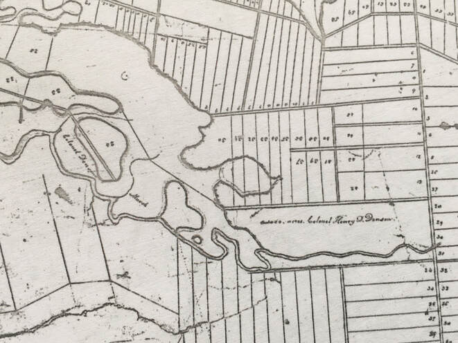
Today I discovered something that has been right under my nose all along. Henry Denny Denson's grant, which Robert Ripley leased, consisted of 5 lots of upland numbered 70-75 and 5 marsh lots also numbered 70-75. I thought that all of this property straddled the Nappan River and lay east of the highway. However, today I was taking a closer look at a map of the Amherst Town Lots I found in the Ernest Coates map file, and I noticed that Henry Denson's grant was marked on it. Then, to the west of his grant, was a long strip of marsh on the north side of the Nappan River labeled "Colonel Denson's Marsh". The marsh extended so far west on the Nappan River it would have been opposite the properties of the Goulds, Henry Ripley, and possibly even George Noils.
Then I had another look at the map Thomas Cochran made of the property after he acquired it from Denson's daughter. Sure enough, there's the "marshland of Thomas Cochran" extending far to the west of the rest of the grant. I had looked at it before and assumed that marsh was a separate property Cochran had acquired. Here's a link to view the map online.
I've been tearing my hair out trying to figure out how a property that Thomas Bacon purchased from Cochran's descendants could be bordered on the south and east by the Nappan River and on the west and south by Francis Smith. But this would make sense if the property was west of the highway.
 RSS Feed
