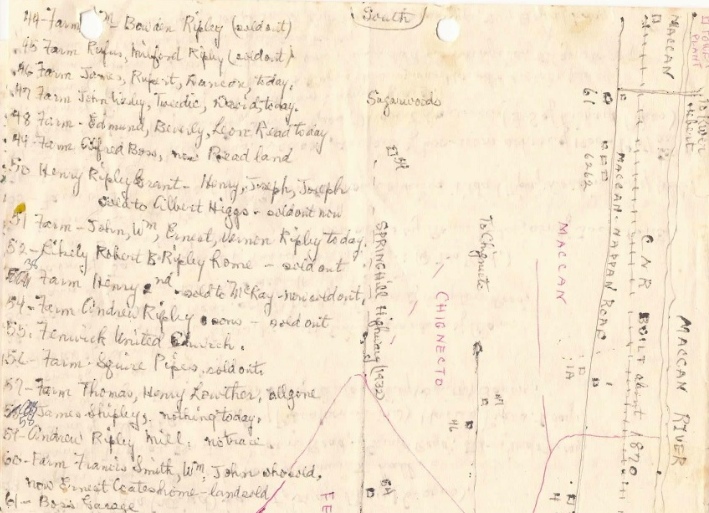
I have very exciting news! A few years ago Gord Ripley gave me a map hand-drawn by Ernest Coates indicating many of the original homesteads in Amherst, Maccan, Nappan, and Fenwick. Today, when I asked him whether I might share it on the website, Gord said he thought Ernest would have definitely wanted to share the map and that he would have loved the internet.
The map has been an excellent starting point in my research of the Ripley and Coates homesteads. The homesteads are marked on the map with numbers and a key is provided. I would caution that not all of the names associated with an entry were necessarily owners of that particular property. Sometimes Ernest was just identifying family relationships.
It has been considerable work to research just one family. I can only imagine the countless hours Ernest spent tracing the homesteads of virtually all of the original families in the area. You can download the map from the Cumberland County Maps page on this website. Enjoy! I would love to hear from anyone who is able to verify Ernest's information. Imagine working together to continue identifying all of the original homesteads!
 RSS Feed
