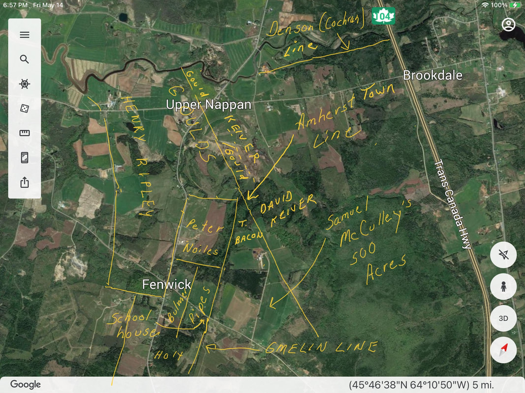
My previous 7 posts are the result of a year-long study of the properties on the boundary between the original Gmelin grant and Amherst Township. The rough sketch above shows the properties covered. I've sketched the Noiles, Bacon, Keiver and Gould properties as if they came to a nice neat logical point at the tip of the Samuel McCully Grant, but of course they did not. The deeds provide only a rough idea of the location of the properties relative to each other, so it must have been a nightmare for property owners in the area to finally sort out their actual boundaries. I hope they at least had good fences and windrows. Apparently there's a deep gorge and even a waterfall in the location that probably made the task even more difficult.
I had originally attempted to discover the location of the Gmelin Line, the supposed boundary between DesBarres and Amherst Township. I was able to confirm the location of the Gmelin Line where it ran north/south just east of the Fenwick Community Hall on the original Squire Pipes homestead as Myrtle Chappell had reported. The next time I'm in town, I plan to go there and jump up and down on the spot.
I was unable to discover the location of the Gmelin Line in the section that ran with a northwest bearing through the Gould properties. In fact, locating the Gmelin Line become secondary to finding the Roach Line that lay east of the Gmelin Line and redefined the boundary between DesBarres and Amherst. My best guess is that the Gmelin Line ran west of the Nappan Road/Hwy2 intersection and the Roach Line ran east of the intersection.
My next project is looking at the 100-acre lots that lay east of the Roach Line and ran in a north/south orientation. These appear to be, from west to east, Amherst Township lots 17, 16, 15, 14 and 25. Between lot 25 and Cobequid Road, there is another bank of 100-acre lots that ran in an east/west orientation. After 10 years of research, I haven't a clue what happened to the lots 18-24 marked on old maps south of the Nappan River. But I can at least describe the actual lots that remained. I have to chuckle every time I look at the Crown Land Index map and realize that even their surveyors didn't tackle this area other than marking in the Gmelin Line.
 RSS Feed
