Other Smith Road Properties: the Moffat Lots
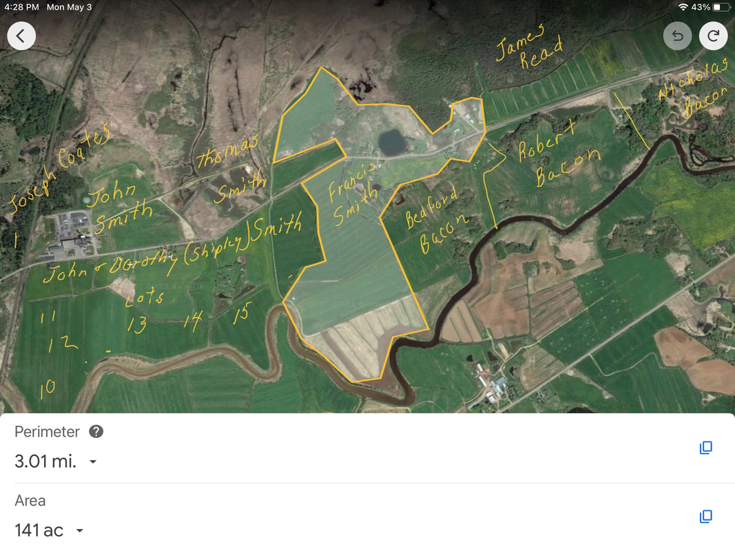
Thomas Cochran's daughter Isabella Ramsay had inherited a sizeable chunk of real estate located west of today's Highway 2 and north of the Nappan River. This included the lands she sold to Francis Caleb Smith, and lands originally belonging to the Denson Grant bordering on the Nappan River plus additional properties that William Cochran purchased from the estate of John Young. According to Thomas Cochran's Map, all of these properties lay south of the boundary with the Amherst Common Lots and north of the Nappan River. The properties marked by the letter A on Cochran's map had been purchased from John Young's estate by William Cochran, but properties marked by the letter B were not part of Cochran's property and belonged to the Read family. On today's map, the properties stretch roughly from about the railroad tracks on Smith Road to the small pond that is located on the original homestead of Francis Smith. The deeds of sale for these lots all refer to a plan made in 1837 by William Moffat.
As mentioned above, Isabella Ramsay did not own all of the land in this area. A strip of land running horizontally through these lots was the property of Dorothy (Shipley) Smith, widow of John Smith. So the properties are best considered in 3 roughly horizontal sections from north to south.
The northernmost section, about 102 acres, was bordered on the south by today's Smith Road and on the north by the Amherst Common Marsh Lots and properties of Joseph Coates. The middle section, about 90 acres, belonged to the Widow Smith and was bordered on the north by Smith Road. The south section was bordered on the north by Widow Smith and on the south by the Nappan River.
See Smith Road: North Section, Smith Road: Middle Section, and Smith Road: Southern Section on this website for detailed information on these properties.
