Grant of Joseph Black Ripley and Thomas Ripley
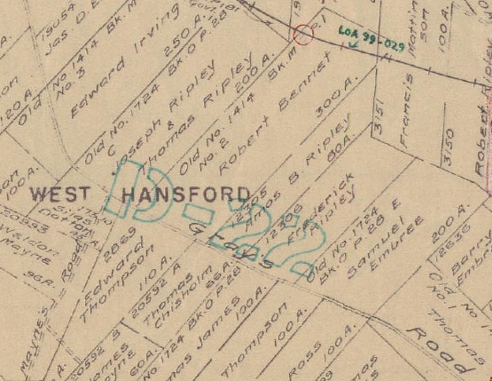
In 1825, John Ripley's sons Joseph (1803-1879) and Thomas (1801-1871) petitioned for land "laid off" by their father. On Crown Land Index Map 69, it is possible to see a grant of 200 acres to Joseph and Thomas Ripley that lies just to the southeast of the Moses Delesdernier grant on Gray's Road, adjacent to a grant owned by Edward Irving. (Old No. 1724, Book O p. 28. Family Search film 8453640 Img 179) On 9 April 1834, Joseph B. Ripley and his wife Charlotte sold 100 acres in River Philip to Henry Main for 20 pounds. (Deed Book T, p. 58). The property, located in West Hansford, is described as follows:
"situated on the North East side of Greys Road and butted and bounded as follows that is to say beginning at a Maple Tree standing at the southern angle of Edward Irvins Land at River Philip then running North 39 Degrees east 82 chains and 50 Links 77 chains to the road leading to Thomas Greys land thence North 70 Degrees West to the place of beginning (as by reference to the grant and plan thereof will more fully appear Grant Dated 12th May 1829."
Henry Mayne, to whom the property was sold, became the husband of John Ripley's daughter Esther the following year. Having sold their portion of the grant to brother-in-law Henry Mayne, Joseph Black Ripley and his wife Charlotte later settled in Williamsdale on the Belle Johnson property. He and Charlotte are buried in the Williamsdale Cemetery along with many of their descendants. John's son Thomas and his wife Priscilla apparently remained on Gray's Road in West Hansford as Gray's Road is given as the birthplace for several of their children on marriage and death records. Priscilla is buried in the Mt. Pleasant Cemetery. I was unable to find Thomas's grave.
In 2017 I attempted to locate their original grant. There is no longer a Grey's Road, but there is a Hansford Road off Water Street in Oxford. Just opposite Thomas and Joseph's grant on the map above, you will see a Mayne's Road coming in from the lower left. I was able to find a well-traveled gravel road called Joe Maine Road, unmarked with a street sign but identified by my GPS. A very picturesque old barn was located just opposite Joe Maine Road.
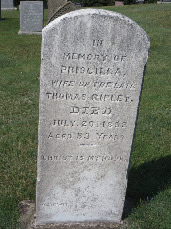
Priscilla (Embree) Ripley's grave in the Mt. Pleasant Cemetery.
|
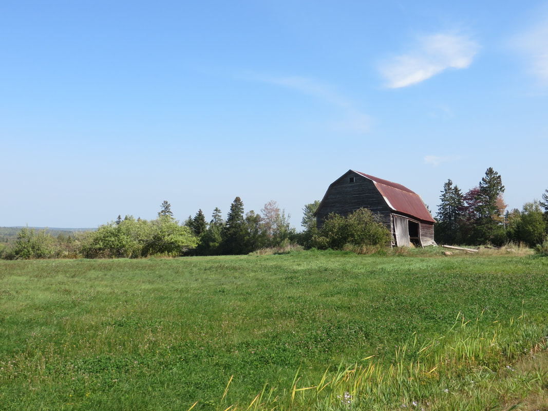
Barn across from the intersection of Hansford Rd. and Joe Maine Rd. in West Hansford near Oxford.
|
